RICHARD S. DARGAN | Architecture
The Central Artery | |||||||
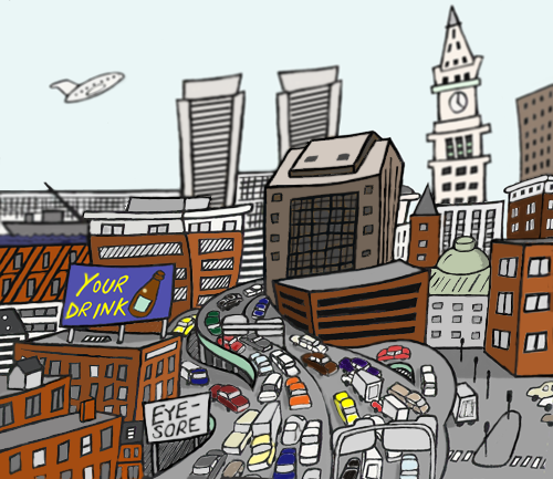 |
Completed: 1951-1954; demolished ~2003 Elevated highways proved irresistible to 20th century urban planners looking for convenient ways to spirit cars and trucks through cities and ease traffic on surface roads. Manhattan's West Side elevated highway in the 1920s was the first, and many more came along during the post-World War II interstate highway building boom. There was the Central Freeway in San Francisco, I These "highways in the sky" proved to be a failure on almost every level. They increased congestion and noise pollution. They created "border vacuums," effectively cutting neighborhoods off from each other. And because politics played a major role in their locations, elevated highways tended to disproportionately affect minority communities like San Francisco's Hayes Valley. The Central Artery was no different. It was clogged with bumper-to-bumper traffic much of the time. and it virtually walled downtown off from the waterfront and the North End. Now it is gone, another notable example of the movement from highways to boulevards that is a cornerstone of today's New Urbanism. |
||||||